The next leg of our cycling trip saw us biking alongside the River Panj for several days. The Panj is a river in a remote part of the world that undertakes a beautifully varied journey: it starts among the high glaciers of the Big Pamir, a triangle of extremely mountainous land bordering China, Pakistan and Afghanistan. It then heads south through the wide braided plains of the Wakhan corridor, before it narrows and steepens into whitewater rapids toward Khorog and beyond to Uzbekistan. For the stretch we cycled it also signifies the border between Afghanistan and Tajikistan.

The Foreign Office advises against all travel to the Afghan side but ‘only’ against all but essential travel to the mountainous Gorno-Badakhshan Autonomous Region (GBAO) of Tajikistan (where we rode). The Afghan Wakhan up until pretty recently had been visited by a handful of adventurous tourists for the remarkable trekking in the area but it is now deemed off limits again due to safety concerns. Whether these warnings are deserved is another debate. In fact the only nearby border crossing into Afghanistan at Ishkashim (or Eshkashim, Ishkoshim etc.) was firmly closed when we rode past.
The border guards looked pretty fierce:

Cycling for a while in this area might sound foolish, but in reality the Wakhan is a remote finger of North Western Afghanistan that’s cut off by high mountains and deep rivers. The Taliban have never ventured into the Wakhan and only the recent operations by the Afghan military has pushed them nearer. Yes, it is supposed to be a major opiate drug smuggling route but certainly on the Tajik side very little impact is felt here.

Cycling along the rough track on the Tajikistan side meant we were constantly just a few feet of water away from Afghanistan and this proximity to such an inaccessible but beautiful country gave us a fascinating, if rather voyeuristic look into village life there. We waved over to locals out collecting hay as we went, heard kids playing outside school and watched as a couple of cars tackled the sketchy ‘road’ blaring out funky music. We discovered the Wakhan to be an unique and beautiful place that we were honored to have experienced……

Getting back to the blog, we quickly rode past the Tajik military check point at the head of the Wakhan valley and put our heads down to get some miles between us and the soldiers.

After about 20 minutes of riding through a moonscape curtained by snowy peaks, we started looking for hidden spots to wild camp, but time seemed to go by faster and faster and there was nowhere appealing to camp at all. Everything suddenly felt like a bad idea: Why were we in this valley next to Afghanistan? Why didn’t we camp higher up? Why didn’t we take the main road? should we have camped by the soldiers? The concept of camping in the open next to somewhere that the media tells you is death defyingly dangerous made us feel uneasy. 
My nerves weren’t helped a few kilometers later as I noticed a group of horsemen standing by two small shelters on the Afghan side, they had just arrived and the dust kicked up in their wake was still settling in the long evening shadows along the rough path. I could make out the traditional Afghan tunic and trousers as well as their flat round felt hats, but immediately I was wondering what they were doing up here, miles from the nearest village or road. They were probably drug smuggling – that was clearly the only logical explanation I thought in my irrational exhausted state. Other than them the Afghan side was empty, and I mean totally empty, not even a tree to be seen.

We slogged onwards along deep sandy sections of road, pushing and struggling with our bikes, we were rapidly running out of daylight and we finally decided to camp on a high terrace we spotted above the road. We were pretty much out of sight, so finally a good spot to pick. We sat down exhausted and set about cooking dinner, it was then that I noticed the train of camels arriving over the river. They were large double humped Bactrian camels in a distinctive black and ginger colouring (they were a bit far for my wide angle lens but the picture above shows them the next morning). I reflected that it was exactly the scene we could have witnessed 200 years ago, while we watched them drinking from the river. To complete the scene there was a small building nearby. It was an old travelers rest house, a mud domed roofed room about 4x4m in size, with no windows just a low door. We frequently saw these huts which would have served the ancient silk road travellers. It was a magical sight in the long shadows and golden evening light. This was a similar shelter further down, just a simple mud room:

We slept well but got up early to ensure we were packed up and on the road promptly. We were very keen to get to some kind of civilization, it had been a while out in the wilds and Marion was still feeling a bit sick from something. We cooked porridge for breakfast on the banks of the river Panj watching the camels graze. We saw no cars nor people all morning. Well other than some Frenchies on tandems, but you expect to see some French in all the remote corners of the planet.

It was a good job we left early as the road was longer and rougher than we imagined, however the scenery along the way was above even my highest expectations.

This ‘easy’ downhill section along the river took all day to ride. The road was bad, in places the sand was almost a foot deep. We had to push a little but generally the gradient downhill helped us keep some momentum.

The river eventually narrowed into a deep canyon as we climbed high up above it. This was tough cycling but we were more than rewarded with vast vistas of the Wakhan mountains.

The road stayed high, winding in and around large hanging side valleys. We got ever nearer to Langar, where we planned to stop, and we overtook a number of stock men walking goats or cows towards the village. They must camp or live in the open during the summer to graze animals along this high pasture. We passed a couple of tourist jeeps driving through on some organised ‘extreme’ tour, the occupants all piled out to take photos of us cycling along the dramatic road. We had this happen a couple of times during the trip and I must confess I found it a bit odd and didn’t pose for pictures. Maybe they had recognised Marion from her work at the modeling agency in Edinburgh!

The dry dusty landscape finally gave way to a sight so stunning and unexpected we didn’t really know what to make of it. The pictures don’t do justice to the view. It was extraordinary pure geography fest. I’ll try to explain it: the deep narrow gorge we had been following fed along to a vast perfectly flat river valley about 2km away, from the valley floor vast 6500m+ mountains rose up. What added to the drama was that the valley was heavily forested in lush greens, the first trees we had seen in 7 days of cycling. There was very little evidence of humans other than some field terraces and a castle ruin sitting proud on a rocky outcrop where the canyon joined the flat wide valley.

But what made the sight unbelievable was an optical illusion that had us convinced the river on the flat plain fell straight of a cliff straight down into the vast rocky canyon we had been cycling along. But we knew the river was flowing in the other direction so there had to be another explanation.

What actually happened was the canyon narrowed and hidden behind the rocky hill with the castle on it had curved sharply, the canyon was actually much higher than the forested plain, our eyes were just tricked in a MC Escher kind of way!

After this weird geographic illusion we next had a biblical surprise. The road descended sharply and we finally left the desert’s dust and rock, we overtook numerous donkeys loaded with freshly cut hay. The sun was getting lower and illuminating the dust they kicked up in a surreal beautiful light. We then reached the first trees we had seen in 10 days. It was a true oasis. Apricot trees hung heavy with ripe fruit, apples were ready to eat, huge popular trees added depth and height and all the houses had well stocked self sufficient vegetable patches filled with potatoes, cabbages, beans etc. It was like we had arrived in the garden of Eden.

While the area received limited rainfall it was superbly irrigated by snow melt rivers carefully split into numerous channels.
We have never arrived anywhere so peaceful and idyllic, the experience was certainly heightened by arriving here after days of riding across the barren high altitude plateaus of the Pamirs.
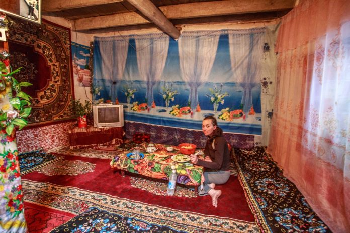
We were offered an unofficial but comfortable homestay in Langar village and quickly accepted. We decided to take a day to relax here, they even had a TV, but I didn’t dare plug it in as the socket was attached by bare metal wiring….

The Wakhan valley has a long history of inhabitants across a huge variety of empires and civilisations and there’s lots of interesting history left behind. Langar has an ancient castle protecting the silk road and lots of Petroglyphs to explore.

The next day we walked up to see the petroglyphs and tried to decipher the really old from the newer rock art. In the village we visited the only shop, which had very limited stock. With the locals being pretty self sufficient there’s limited disposable income to spend on anything else. The upside of this was that there’s no litter, the whole valley was remarkably free from the curse of plastic and other waste which is such a rarity in so much of the world. We were shown the village flour mill, powered by water locals brought their grain and left with flour. The guy miller looked like an older Fonz from Happy Days.

We had a comfy homestay, but the food was basic carbs for every meal. We were crying out for dietary fibre after: Plain pasta, bread, noodles, plain Potatoes, more bread then repeat. There’s only so many apricots we could eat to supplement it!

From Langar the road improved and the valley carried on much the same over the next few days. The fields were busy with hay being cut down under the perfect blue sky.

We saw a couple of shops, this bus was one of them, a bit like Tesco express:

Marion took some coloured Barbie pens and some fun animal stickers for kids and she was always popular when we stopped:
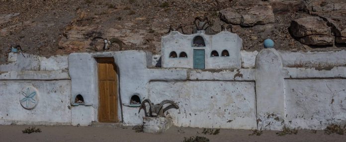
We passed a Buddhist stupa from the days when Tajikistan was mostly Budhist, also many relics from various cults; like a Mazar or shrine surrounded by Marco Polo sheep heads both relics from very different civilisations and religions that have existed here.

Finally we reached Tuggoz and the Yamchun Fortress with the nearby Bibi Fatima hot springs. Another great spot we just had to stop and explore. Built in the 3rd century BC, Yamchun fortress is apparently locally called Zamr-I Atisht Parasht, the fortress of the fire worshipers, meaning Zoroastrianism was also strong in the Pamirs back then. A fire temple was probably housed inside the fortress, which sounds like a safety hazard.

Down the road from the Castle we stayed at a homestay run by the local headmaster. He was a Russian teacher with no English, but in his defence he did speak 5 languages; Russian, Tajik, Wahki, Kyrgyz and Farsi. He was super friendly and we had a great ‘chat’ including learning number in many languages. Each valley in the Pamir has its own language so communicating must be hard. Luckily his daughter-in-law arrived later and translated for us which was really useful to help us get a fascinating insight into what life was like in the Wakhan villages.

The next day we wandered uphill to the hot springs. A surprisingly smart building housed two hot pool rooms one for each sex, the protocol was naked bathing only. It was the first proper wash in a while so I sat near the outflow for other peoples benefit. Marion took soap and shampoo along too for hers! It was a refreshing experience sitting watching the hot water flow out of a natural rock face into the pool. We had seen a few hot springs along the road, but this was by far the best, the others were just dirty looking concerete pools or coloured dirt like this:

We still had a short section of the Wakhan left to cycle but our attention was soon turning to Khorogh and how long it would take us to get back to Osh. The problem with short trips is that the end looms quickly on the horizon.

